If you want to check on the hikes that I completed so far as part of this challenge, go here.
Prologue: A hiking challenge is going on this year by the Department of Environmental Protection (DEEP) in the state of Connecticut where I live, “Sky’s The Limit”. We have to finish a hike in the chosen 20 Park and Forest locations before December 3rd this year Each location has some specific points of interest that the departments asks us to take pictures of and document them. Most of the Parks and Forests are located in an hours of driving distance, except a few. I decided to take this challenge and hopefully will be able to complete all of them. Here we go!
Next up is Sherwood Island State Park. This is # 15 on the list provided by DEEP. I am not following the order they have listed. I am just going to any hike I can whenever I can from that list. 🙂
Sherwood Island State Park in Westport, Connecticut is the first state park to be formed in the state of Connecticut. 235 acres in the Green Farms section of Westport, it is bounded on the west by the Mill Pond and on the east by New Creek. Until I reached the park I didn’t realize it was truly on an island. It looked so much connected to land.

It is fairly a flat 1.5 miles hike around the Park which gives all kinds of activities for everyone – Picnicking in and around shaded groves; swim in the Long Island Sound; enjoy the flora and fauna of the marsh land from the viewing platform; visit the Nature Center; Saltwater Fishing; and also fly your model aircrafts.
There is a Picnic shelter, a rather large building with all facilities inside. What captured our interest is the artwork on the walls made out of waste either found on the beach; or volunteers who donated stuff from their homes that they were discarding. This one urges about conserving water and that it begins with you.

This is a for 100 years for 100 trees campaign that will keep Sherwood Island growing for another 100 years. The Friends of Sherwood Island replace these 100 year old trees and restore badly damaged wildlife habitats.

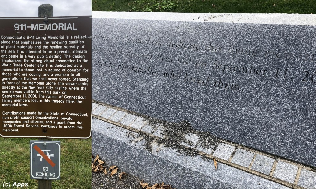
The Beach walkway took us to the Living 9/11 Memorial, a place from where viewers could see the smoke coming out of the twin towers across the New York Skyline.
We walked back to the Nature Center. Here is where we struggled a bit to find the Nature Trail. Although the map showed it but we couldn’t figure out how to go.

Finally we took a guess and walked along the parking lot of the Nature Center, and voila! we found the Nature Trail. Along the trail there are multiple stops and perhaps should have had some kind of writeup on these little marker pillars. However I didn’t see any of them having any kind of note about the surroundings. However I loved the marsh area which gave a good photo backdrop.

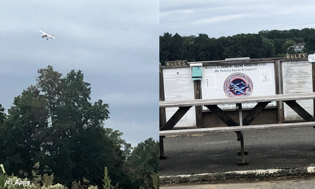
And yes we got to see some flying enthusiasts flying their model aircraft planes.
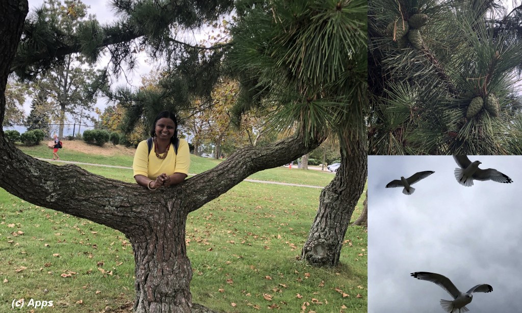
We also saw some seagulls flying closer to us; this interesting tree growing in two ways creating a natural seat for sitting; and these large pinecones sitting pretty.
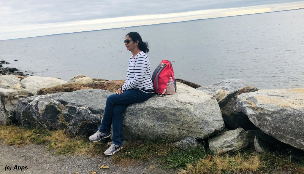
And finally here is my friend enjoying the shore and also who helped me finish the hike.